Roughly a third of Osaka’s urban area — the wards that line Osaka Bay, the industrial islands, the airport, and the Expo site — sits on land that was open seawater within living memory or recent geological time. The mechanism is umetatechi (埋立地), Japan’s centuries-old practice of filling the sea with soil, dredge spoil, and eventually municipal waste, and it has been reshaping this city continuously since the age of Toyotomi Hideyoshi; what makes Osaka unusual is not that it reclaimed land, but that it never stopped, and that the sea keeps pushing back.
Why we can tell you this — MICHI is written by an Osaka-based editorial team that can walk the Uemachi Plateau, stand on the Yumeshima seawall, and watch the Kansai International Airport terminal from the ferry. This article draws on the Water City Osaka municipal heritage project, the Nippon.com historical survey, the Bureau International des Expositions’ urban strategy documentation for Expo 2025, and geotechnical and environmental reporting from Smithsonian Magazine and Deeper Japan. Where precise figures are contested — particularly the total proportion of the city that is reclaimed versus naturally formed alluvial land — we note the range rather than assert a single number.
Stand on the observation deck of Abeno Harukas on a clear winter morning and look west. The city spreads flat and grey-silver all the way to the bay, and then the bay itself is interrupted by the geometric rectangles of artificial islands — Sakishima, Maishima, Yumeshima — before the water opens again toward Awaji Island and the Seto Inland Sea.
What you are looking at is not a natural coastline. It is a coastline that has been argued with, negotiated, and ultimately overwritten, layer by layer, for at least four centuries of deliberate human effort — and for thousands of years before that by rivers doing the same work without human instruction.
The question of how much of Osaka used to be sea is not a simple one, and that complexity is itself the story. The answer changes depending on which century you stand in, which definition of “Osaka” you use, and whether you count the slow geological filling of ancient bays as reclamation or simply as time.
But the broad answer is this: almost everything west of the Uemachi Plateau, and a great deal of what lies east of it, was once underwater. The city you walk through today is, in large part, an argument against the ocean — and the ocean is still making its counter-argument.
Why Was Most of Osaka Underwater to Begin With?
The geological foundation of the story is the Jomon Transgression — the post-Ice Age rise in sea levels that peaked roughly six to seven thousand years ago. Water City Osaka records that at this peak, the sea level of Osaka Bay was one to two metres higher than it is today, and the coastline extended deep into the area near the foot of the Ikoma Mountains.
Think about what that means in terms of the modern map. The Ikoma Mountains form the eastern edge of what is now Higashiosaka City.
The sea, at its Jomon maximum, reached almost that far. Wikipedia’s entry on the Uemachi Plateau, drawing on post-war geological studies, confirms that the plateau was then a sandbank separating the Inland Sea to the west from Kawachi Bay to the east — a narrow spine of habitable land in a largely marine landscape.
The Uemachi Plateau itself is only about twelve kilometres long and 2.5 kilometres wide. Osaka-Info’s heritage itinerary describes it as jutting into the sea like a peninsula, with islands visible from its northern tip.
The highest point of the plateau — 38 metres above sea level — is directly beneath the main tower of Osaka Castle. That is not a coincidence.
It is the reason the castle is there.
The eastern bay, Kawachi Bay, was a separate body of water. As a sandbar extended northward from the tip of the Uemachi Plateau, it gradually enclosed Kawachi Bay, transforming it first into a lagoon, then into Kawachi Lake, and eventually — through the combined action of river sediment and human drainage — into the flat agricultural plain that underlies much of eastern Osaka today. Water City Osaka traces this sequence precisely: crustal uplift and river deposition together pushed the western coastline significantly further out, forming the present-day Osaka Plain.
By around 700 AD, geological records suggest that the region directly east of the Uemachi Plateau had been largely filled in by debris and sediment from the Yamato and Yodo Rivers. The sea had retreated. But it had not gone far.
Why Did the City Grow Westward — Into the Water?
The answer to this question is political before it is geographical. When Toyotomi Hideyoshi chose the northern tip of the Uemachi Plateau as the site for Osaka Castle in 1583, he was placing his power at the highest natural point in a landscape that was still largely marsh, tidal flat, and shallow bay to the west and north. The castle was defensible precisely because water surrounded it on three sides.
But Hideyoshi did not simply build a fortress. He built a city.
Water City Osaka’s historical archive records that in parallel with the castle’s construction, he dug the Higashiyokobori River as an outer moat, built wide streets, standardised building heights, and created an orderly castle town. Merchants competed for permits to excavate canals.
It was during this period that the prototype of what would become the “Water City” took shape, centred on the Senba district.
The canals were not merely transport infrastructure. They were, in a very literal sense, land creation.
Nippon.com’s history of Osaka explains that engineers strengthened the soft, damp soil, turning drainage trenches into navigable canals. The spoil from those excavations was used to raise the surrounding ground.
Every canal dug was also, implicitly, a strip of new land created on either bank.
After the Tokugawa shogunate took control of Osaka in 1615, it set out to excavate a full network of waterways, establishing Osaka as a proper castle town. The Tokugawa approach was systematic: Nippon.com notes that the shogunate turned drainage trenches into transportation canals, and that merchants and craftsmen moved to the city in droves, laying the foundations for the commercial prosperity that defines Osaka’s identity to this day.
Then, in 1684, came a decisive intervention. Water City Osaka records that a canal was dug to divide Kujo Island, which stood in the way of the Yodo River’s mouth.
This Aji River channel allowed floodwater to drain quickly to the sea, reducing the chronic flooding that had plagued the city, and simultaneously opened a navigable waterway from Osaka Bay directly into the city centre. The smooth connection between sea and city accelerated Osaka’s rise as the national logistics hub — the place where rice from the domains of the entire country was stored, traded, and converted into coin.
The Mechanics of Making Ground
The technique of umetatechi — literally “filled-up land” — is older than Osaka’s commercial era. Deeper Japan‘s survey of the practice notes that it has expanded Japan’s territory by an estimated 0.5% over at least 850 years. That figure sounds modest until you consider that two-thirds of Japan is forested mountain, and that the reclamation is concentrated in the bays of the largest, most densely populated cities.
In Osaka’s case, the early method was simple: dump soil and rubble into shallow tidal flats, wait for it to consolidate, then build on it. The canals provided both the excavation spoil and the drainage needed to keep the new ground from reverting to marsh.
Later, as the Meiji era brought industrialisation, dredge spoil from harbour deepening operations became the primary fill material. Deeper Japan notes that dredging projects from the late Edo through the Meiji and Taisho periods deepened harbours, and the sediments were used to create still more reclaimed land — a self-reinforcing cycle in which the act of improving the port simultaneously generated the material to expand it.
By the time of Japan’s industrial revolution, the process had become explicitly planned. The Bureau International des Expositions’ urban strategy document for Expo 2025 states plainly that by the time of the Industrial Revolution, approximately 30 per cent of Osaka’s city area had been reclaimed. That is a remarkable figure — nearly a third of the city, created from nothing but shallow water and human labour.
Why Did Industrialisation Accelerate the Process So Dramatically?
The Meiji Restoration of 1868 transformed Osaka from a merchant city into an industrial one. Nippon.com records that the city was nicknamed the “Manchester of the East” — the Meiji government constructed the Osaka Mint and the Osaka Arsenal along waterways, while private enterprise drove the machinery industry and shipbuilding. Cotton spinning drew particular comparisons to the British industrial model.
Industry needed flat land near water. Osaka had very little flat land that was not already built upon, and the land it did have was expensive.
The bay, by contrast, was free — or at least, the cost of filling it was lower than the cost of acquiring urban real estate. The coastal wards that now form the industrial western edge of the city — Konohana, Minato, Taisho, Suminoe — were built largely on reclaimed ground during this period.
Osaka.com’s history of Taisho Ward describes the area as a “modern frontier” — a place that attracted innovative minds precisely because it was new, unencumbered by the social hierarchies of the older city. The ward’s bridges are all elevated to allow tall cargo ships to pass beneath them, a detail that tells you everything about how recently this land was water.
The Port of Osaka, established during the Meiji period and expanded repeatedly before the Second World War, became the engine of this transformation. Deeper Japan notes that Japan’s postwar recovery, buoyed by American investment during the Korean War, directed industrial development toward exporting, and with a lack of available real estate around harbours and historically weak powers of eminent domain, this meant the rapid creation of more artificial land. Umetatechi development, often hastily built, exploded in Osaka, Tokyo, Nagoya, and Kobe.
The consequences for Osaka Bay were severe. Japan’s government publication Highlighting Japan records that up until around 1955, the bay was dotted with sandy beaches that locals enjoyed for bathing and clamming.
During Japan’s rapid economic growth period, land reclamation advanced along coastal areas as the region became a hub of distribution and production. As a result, natural beaches, seaweed beds, and tidelands shrank or disappeared, and the enclosed bay became prone to stagnation, red tides, and oxygen depletion.
“Large factories had been built on many plots of reclaimed land around the closed-off sections of Osaka Bay, including an industrial zone for heavy and chemical industries, and we suppose that depressions scooped out of the seabed due to reclamation work and changing tidal streams from reclaimed land have had an effect on the environment in Osaka Bay.” — Yoshiki Matsui, Senior Officer for Engineering Planning, Ministry of Land, Infrastructure, Transport and Tourism, quoted in Highlighting Japan, April 2018
Why Did Osaka Keep Reclaiming Land Even After the Bay Was Damaged?
The answer is that the logic of reclamation is self-perpetuating. Once a city has committed to expanding into the sea, the infrastructure built on that reclaimed land creates demand for more reclaimed land adjacent to it.
Ports need expansion. Industrial zones need buffer zones.
Waste disposal — the unglamorous engine of postwar reclamation — needs somewhere to go.
From 1958, Osaka began developing artificial islands off the coast of Osaka Bay. The BIE’s urban strategy document identifies three such islands created under the “Technoport Osaka” plan: Sakishima, Maishima, and Yumeshima. These are not extensions of the existing coastline — they are discrete islands, separated from the mainland by water, connected by bridges and tunnels.
Sakishima (also known as Cosmo Square) became the site of the World Trade Center Osaka and various government and commercial facilities. Maishima became home to a waste incineration plant — designed, with characteristic Osaka flair, by the Austrian artist Friedensreich Hundertwasser, its chimneys clad in mosaic tile. And Yumeshima — “Dream Island” — became the site of Expo 2025.
The story of Yumeshima is a compressed version of the entire history of Osaka’s reclamation. Wikipedia’s entry on Yumeshima records that landfill licensing began in 1977, and land creation started in 1991.
The island was built primarily from gravel, sand, and construction byproducts generated within Osaka City, and was designated as a site for waste disposal including incineration ash. It was, in other words, a rubbish dump — a place to put what the city no longer wanted, in water the city no longer needed.
Then ambition intervened. The BIE document notes that in the early 2000s, before the Expo bid, the land reclamation project was promoted with the aim of creating a concentration of business and commercial facilities and a large-scale residential zone — with the 2008 Olympics bid also in mind.
Osaka lost that bid. But the island remained, and the ambition was redirected toward the 2025 World Expo.
Just over 29 million people visited Expo 2025 Osaka, arriving from all over the world to take in the various technological and cultural wonders. But the most impressive part of the world fair may have been the ground beneath their feet, as the entire event took place on the still-expanding artificial island of Yumeshima, which will be nearly four square kilometres upon completion.
Why Is the Ground Itself the Most Dangerous Thing About Reclaimed Osaka?
Every piece of reclaimed land in Osaka Bay carries a geological debt. The debt is called liquefaction, and it comes due during earthquakes.
Liquefaction occurs when water-saturated, loosely packed soil — exactly the kind of material used to fill shallow bays — is subjected to seismic shaking. The soil particles lose contact with each other, the ground temporarily behaves like a liquid, and anything built on it sinks, tilts, or collapses.
Japan Remotely’s disaster planning guide identifies Konohana Ward (home to Universal Studios Japan), Nishi, Minato, Suminoe, and Taisho Wards as all built on reclaimed or alluvial land with high liquefaction risk. Even Osaka’s historical core shows moderate risk, as many former river channels and wetlands were filled centuries ago.
The 1995 Great Hanshin Earthquake provided a preview of what this means in practice. The same guide notes that Kobe’s artificial Port Island and Rokko Island suffered severe liquefaction during that earthquake. Osaka’s reclaimed wards were close enough to feel the shaking, and the lesson was not lost on engineers — though the political will to stop building on reclaimed land was another matter entirely.
The longer-term threat is sea-level rise. Earth.Org’s sea-level projection for Osaka cites a 2008 OECD report identifying Osaka as one of the most vulnerable port cities in the world, at risk of USD $200 billion in damage from coastal flooding. The dykes and flood gates on the Yodo River can withstand a one-in-200-year flood — but sea-level rise is shifting the baseline, so that a one-in-200 event gradually becomes a one-in-100 event, then more frequent still.
Typhoon Jebi in September 2018 made this abstract risk concrete. Earth.Org records that eleven people were killed and 700 injured, a massive oil tanker crashed into the bridge connecting Kansai International Airport to the mainland, and the airport itself was flooded. The airport — the most extreme example of Osaka’s reclamation ambition — was suddenly the most visible symbol of its vulnerability.
Why Is Kansai International Airport the Most Extreme Case?
Kansai International Airport is, in engineering terms, the most audacious piece of reclaimed land in Japan, and possibly in the world. Essential Japan describes it as the first airport ever built entirely on reclaimed land in an offshore marine environment — a $19 billion aviation hub constructed on two artificial islands in Osaka Bay, opened in September 1994 after two decades of planning and seven years of construction.
The reason it was built offshore rather than on land is the same reason all of Osaka’s reclamation happened: there was no land. Aerotime notes that with nowhere left on land to expand, the decision was made to construct the airport in Osaka Bay, where its offshore location would not disturb local residents with noise.
Three mountains were excavated to provide the fill material. The seabed at the construction site was more than 60 feet deep, composed of alluvial clay — loose clay interspersed with other materials.
Engineers knew the island would sink. What they did not anticipate was how fast.
Smithsonian Magazine’s investigation reports that Kansai’s islands were predicted to settle evenly over a 50-year period before stabilising at 13 feet above sea level — the minimum elevation required to prevent flooding if the encircling seawall were breached. Instead, portions of the first island reached that threshold within six years.
“Since it opened in 1994, Kansai has sunk 38 feet.” — Smithsonian Magazine, “The Airport Is Sinking”
The underlying problem is the layers of clay beneath the artificial island. The B1M explains that while engineers consolidated the upper clay layer, the deeper strata — riddled with pockets of sand — proved more unpredictable. The subsidence occurred at a much faster rate than modelled, sinking by more than 12 metres within the first eight years alone.
As of the most recent operator data cited by the South China Morning Post, the surface of the airport’s first island is today about 3.84 metres lower than when it opened in 1994, with an average settlement since landfill began of 13.66 metres. The rate of sinking has slowed — from 19 inches per year in 1994 to around 2.3 inches per year in 2023 — but it has not stopped. Some engineers project that sections of the two islands may reach sea level by 2056.
At least $150 million has been spent raising the seawall. The airport is simultaneously one of the great achievements of Japanese civil engineering — it survived the 1995 Kobe earthquake with its epicentre only 20 kilometres away — and a monument to the limits of building on the sea. It has never lost a single piece of baggage in three decades of operation, and it may eventually be claimed by the water it was built upon.
Why Does the Ancient Geography Still Shape the City You Walk Through Today?
The Jomon sea did not simply disappear. It left its shape in the city.
The Uemachi Plateau — that original peninsula of dry land — is still the spine of Osaka’s oldest institutions. Osaka Castle sits at its northern tip, on the highest natural ground in the city.
Shitennoji, one of Japan’s oldest Buddhist temples, built by Prince Shotoku in 593, stands on the plateau’s southern end. The ancient port of Naniwa-tsu, where diplomatic missions from China and Korea arrived to be received by the imperial court, was located on the plateau’s western slope — in what is now the Chuo Ward business district.
Nippon.com’s guide to the Osaka Museum of History notes that the Yodo River from Lake Biwa and the Yamato River from the Nara Basin flow westerly into Osaka Bay on either side of the Uemachi Plateau, and that over eons, these rivers deposited sediment to form the broad delta on which Naniwazu — the most important port in ancient Japan — was established. The rivers built the city before the engineers arrived.
The ward names encode the geography. Wikipedia’s Uemachi Plateau entry notes that the names of Higashinari-ku (East Nari) and Nishinari-ku (West Nari) originate from the formation of the plateau — “nari” referring to the process of the land becoming dry. The city’s administrative divisions remember, in their names, the moment the sea retreated.
The ancient Sumiyoshi Taisha shrine, one of Japan’s oldest, stands in the south of the city facing west — toward what was once the open sea. Nippon.com records that the shrine’s three halls face westward to the sea like a fleet of ships, their deities either masters of the water or patrons of sailors.
When the shrine was built, the sea was close enough to matter. Today, the shrine is surrounded by residential streets, and the sea is several kilometres away — pushed back by centuries of reclamation.
The shrine’s orientation is now a compass pointing at a coastline that no longer exists.
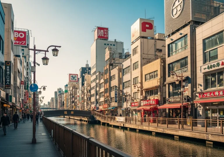
Dotonbori, the neon-lit canal that has become Osaka’s most photographed street, is itself a product of reclamation logic. The canal was excavated in 1615 — the same year the Tokugawa shogunate consolidated control of the city — and the spoil from its excavation raised the surrounding ground.
The entertainment district that grew up along its banks was built on fill. The giant mechanical crab, the glowing billboards, the crowds pressing along the canal at midnight — all of it rests on ground that was once tidal marsh.
Why Should a Discerning Traveller Care About Any of This?
The easy answer is that it changes how you see the city. Once you know that Namba, Shinsaibashi, and the entire western half of central Osaka are built on reclaimed land — on ground that was shallow bay or tidal flat within the last millennium — the city stops being a fixed backdrop and becomes a process.
You are not walking through a place. You are walking through an argument.
But the deeper answer is that Osaka’s relationship with the sea is the key to understanding why the city has the character it does. Osaka.com’s social history notes bluntly that in the distant past, much of what is now Osaka was underwater, and that Osaka Bay reached as far east as around where Osaka Castle now stands. The city was built by people who had no choice but to be pragmatic — who could not afford to be precious about geography, who had to make land where there was none, who had to trade in a landscape that was half water.
That pragmatism is the root of Osaka’s famous commercial culture, its directness, its preference for function over form. The city was not given its terrain.
It made its terrain. And the people who made it were merchants and engineers and labourers who understood that the sea was not an obstacle but a resource — something to be managed, filled, and put to work.
The reclamation also explains why Osaka’s relationship with its own history is so layered and sometimes so invisible. Unlike Kyoto, which preserved its ancient grid because the terrain was stable and the political will was there, Osaka has been continuously rebuilt on continuously shifting ground.
The city does not preserve its past so much as it buries it — literally, under new fill, new concrete, new islands. The Naniwa Palace, Japan’s first imperial capital, was excavated from beneath a school playground in the 1950s.
The ancient port of Naniwa-tsu is believed to lie somewhere under the modern business district of Chuo Ward, though no definitive archaeological remains have been found.
For the traveller who wants to understand Japan’s third city at a level beyond its food and its nightlife, the reclamation history is the master key. It explains the flat topography, the canal grid, the industrial wards, the artificial islands, the airport that is slowly returning to the sea.
It explains why Osaka feels simultaneously ancient and perpetually under construction — because it is. The city has been building itself out of water for seven thousand years, and it shows no sign of stopping.
What Comes Next — and What Does the Sea Think About It?
The future of Osaka’s reclaimed land is being written right now on Yumeshima. After Expo 2025 closed in October 2025, the island entered its next phase: redevelopment as a mixed-use district integrating technology, tourism, and business, with the MGM Osaka integrated resort — Japan’s first licensed casino — under construction as of April 2025. Wikipedia’s Yumeshima entry records that the Osaka Metro Chuo Line was extended to the island in January 2025, giving it its first rail connection.
But the geotechnical challenges are not abstract. A 2023 geotechnical analysis cited by Grokipedia indicates that without mitigation, residual ground settlement could surpass 50 centimetres across the Expo and integrated resort development areas, potentially exacerbating differential settling in structures over decades. Sea-level rise projections for Osaka Bay forecast increases of 0.5 to 1 metre by 2100 under moderate-to-high emissions scenarios.
The island’s design elevation reaches 11 metres above Osaka datum — affording initial resilience against storm surges and tsunamis up to 5.4 metres. But the interplay of subsidence and relative sea-level rise could erode that buffer over the coming century. Yumeshima is, in this sense, a microcosm of the entire city: ambitious, engineered, and in a slow negotiation with the water it displaced.
Meanwhile, the Osaka Bay Regeneration initiative — a coalition of government agencies, NPOs, scholars, and companies — has been working to restore what it calls the Naniwa Sea. Highlighting Japan records that the organisation’s Sea Group concentrates on refilling seabed depressions caused by reclamation work, while the Land Group works on forest development and sewage treatment.
The monitoring group surveys water quality and marine life. The goal is to restore the bay to something resembling its pre-industrial state — even as new islands continue to be built in it.
This is the paradox at the heart of Osaka’s relationship with the sea: the city that damaged the bay most severely is also the city most invested in restoring it. The reclamation that created the problem is still ongoing, and the remediation that addresses the problem is also ongoing. Both happen simultaneously, in the same bay, funded by the same municipal government.
The sea, for its part, is patient. It has been here longer than the city, and it will be here after the city is gone.
The question Osaka is now asking — quietly, in engineering reports and climate projections and geotechnical analyses — is whether the terms of the negotiation are about to change. The Jomon Transgression raised sea levels and drowned the Osaka Plain six thousand years ago.
The physics that caused it are not unique to the Jomon period. They are happening again, more slowly, and with less excuse of ignorance.
Stand on the Yumeshima seawall on a grey afternoon, with the bay stretching west toward Awaji Island and the wind coming in off the Seto Inland Sea, and you can feel the scale of what has been done here. The island beneath your feet did not exist forty years ago.
The airport visible to the south did not exist thirty years ago. The Expo pavilions that stood here until October 2025 were built on what was, within living memory, open water.
And somewhere beneath all of it, under the fill and the clay and the dredge spoil, the ancient seabed of Kawachi Bay is still there, still soft, still remembering what it used to be.
Frequently Asked Questions
Q: How much of Osaka is built on reclaimed land?
A: By the time of Japan’s Industrial Revolution, approximately 30 per cent of Osaka’s city area had been reclaimed from the sea, according to the Bureau International des Expositions’ urban strategy documentation for Expo 2025. The proportion is higher today when the offshore artificial islands — Sakishima, Maishima, and Yumeshima — are included. The western coastal wards (Konohana, Minato, Taisho, Suminoe) are predominantly reclaimed, as is the entire bay island area.
Q: Was Namba or Shinsaibashi ever underwater?
A: Yes. The area that now includes Namba, Shinsaibashi, and the Dotonbori district was tidal flat and shallow bay within the last millennium. The Jomon-era coastline reached as far east as the Ikoma Mountains, and even by the medieval period, much of what is now central Osaka was marshy, low-lying ground reclaimed through canal excavation and fill.
Q: Is Kansai International Airport really sinking?
A: Yes. Since it opened in 1994, the airport has sunk by approximately 38 feet (about 11.5 metres) in total settlement since landfill began.
The rate has slowed significantly — from around 19 inches per year in 1994 to around 2.3 inches per year in 2023 — but has not stopped. Engineers have spent over $150 million raising the seawall, and some projections suggest sections of the island could reach sea level by 2056 if current trends continue.
Q: Is it safe to visit the reclaimed areas of Osaka?
A: For ordinary tourism, yes. The risk from liquefaction and flooding is a long-term and seismic concern, not a daily one.
Japanese building codes for reclaimed land are stringent, and the infrastructure is continuously monitored. Travellers should be aware that in a major earthquake scenario, reclaimed areas carry higher risk than the Uemachi Plateau — but the same is true of much of coastal Japan.
Q: Where can I see the ancient coastline of Osaka?
A: The Osaka Museum of History, adjacent to the Naniwa Palace Historic Site in Chuo Ward, is the best starting point. The museum’s tenth floor features a reconstruction of the Naniwa Palace’s great hall, and the basement offers guided tours of excavated ruins. The Uemachi Plateau itself — walkable from Osaka Castle south to Tennoji — is the original dry land on which the city was founded.
Osaka Museum of History — Visitor Information
Address: 4-1-32 Otemae, Chuo-ku, Osaka 540-0008 / 〒540-0008 大阪市中央区大手前4丁目1-32
Nearest station: Tanimachi 4-chome Station (Osaka Metro Tanimachi Line / Chuo Line) — 3 minutes on foot
Hours: 9:30–17:00 (entry until 16:30); closed Tuesdays (or following day if Tuesday is a public holiday). Hours subject to change — confirm on the official site before visiting.
Admission: Adults ¥600; high school and university students ¥400; under 15 free. Approx. — confirm current pricing on the official site.
Official site: osaka-museum-of-history.jp